LANDSCAPE OVERVIEW
|
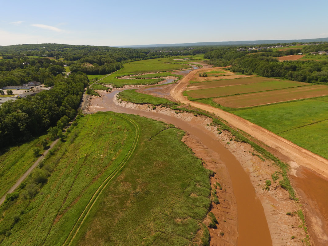
Starting in the 1600s, waves of settlers to the Bay of Fundy coast, starting with the French (called Acadians), used dykes to convert 80% of the Bay’s tidal marshes, creating what remains some of the highest quality farmland in the Maritimes. Today in Nova Scotia (unceded Mi’kma’ki), 241 kilometers of dykes protect 17,400 hectares of increasingly diverse land uses, including residential, industrial and commercial uses as well as significant tourism, recreational and cultural amenity.
Dyke dimensions are inadequate to cope with the increased sea levels and storm surges associated with climate change in this dynamic system and coastal squeeze have removed much of the remnant foreshore tidal marsh that once served to protect the dykes themselves. The provincial department with responsibility over dykes has a mandate only to protect agriculture and is facing difficult decisions about which dykes to reinforce, which to realign, and where to abandon the dykes and restore to tidal marsh. Complex trade-offs exist between the services provided by dykelands and those provided by the tidal marshes they replaced, and which may in some places replace them again. |
CHALLENGES FACING THE BAY OF FUNDY DYKELAND FUTURES
|
|
RESEARCH OBJECTIVES
EXPECTED OUTCOMES
Dykelands have developed heterogeneously, thanks to varying local planning pressures, agricultural viability, conservation priorities and engineering decisions. The primary research, synthesis, modelling and stakeholder engagement in this project is building the necessary evidence base to inform decisions on dykeland futures around the Bay of Fundy. It backfills the local evidence base (e.g. cultural services, cultivated and wild food, pollination, storm protection, climate regulation), and informs the development of effective and acceptable regional resilience options in this vulnerable isthmus jurisdiction. Finally, it establishes a limited set of key variables to monitor to ensure balanced ES delivery into the future.
- What services are delivered by Bay of Fundy dykelands, and how sustainable are those under sea level rise?
- What services are delivered by Bay of Funday tidal marshes, and what is the lag time to their delivery after restoration?
- How do stakeholders trade off different categories of services over space and time?
- What are the implications of the above for dyke reinforcement, realignment and removal decisions?
EXPECTED OUTCOMES
Dykelands have developed heterogeneously, thanks to varying local planning pressures, agricultural viability, conservation priorities and engineering decisions. The primary research, synthesis, modelling and stakeholder engagement in this project is building the necessary evidence base to inform decisions on dykeland futures around the Bay of Fundy. It backfills the local evidence base (e.g. cultural services, cultivated and wild food, pollination, storm protection, climate regulation), and informs the development of effective and acceptable regional resilience options in this vulnerable isthmus jurisdiction. Finally, it establishes a limited set of key variables to monitor to ensure balanced ES delivery into the future.
FOR RESEARCH QUESTIONS, PLEASE CONTACT:
Kate Sherren, Dalhousie University
[email protected] - website
FOR MORE INFORMATION, PLEASE VISIT:
TransCoastal Adaptations Centre for Nature-based Solutions
Kate Sherren, Dalhousie University
[email protected] - website
FOR MORE INFORMATION, PLEASE VISIT:
TransCoastal Adaptations Centre for Nature-based Solutions
LANDSCAPE 1 TEAM LEADS
LANDSCAPE 1 TEAM
PARTNER ORGANIZATIONS
FEATURED PUBLICATIONS
Coming Soon!
In the meantime, check out our Zotero library.


